Difference between revisions of "Category:Maps"
Jump to navigation
Jump to search
(New page: Maps of local races, trails and events.) |
|||
| Line 1: | Line 1: | ||
Maps of local races, trails and events. | Maps of local races, trails and events. | ||
| + | [[Category:Running Routes]] | ||
Latest revision as of 15:10, 13 September 2008
Maps of local races, trails and events.
Media in category "Maps"
The following 135 files are in this category, out of 135 total.
 Ahrr1.jpg 782 × 1,022; 450 KB
 Ahrr2.jpg 782 × 1,022; 458 KB
 Ahrr3.jpg 782 × 1,022; 503 KB
 Ahrr4.jpg 635 × 366; 60 KB
 Ashumet-fal.jpg 1,584 × 1,223; 743 KB
 Bakerspond.jpg 782 × 1,022; 274 KB
 Bankstreetbogs.jpg 570 × 390; 48 KB
 Barclayccf.jpg 784 × 416; 83 KB
 Barclayspond.jpg 2,446 × 3,271; 2.46 MB
 Bearpond.jpg 1,223 × 1,635; 707 KB
 Beebe-fal.jpg 1,584 × 1,223; 564 KB
 Beebe-row.gif 2,144 × 1,641; 70 KB
 Beebe-woods.jpg 1,474 × 1,123; 1.03 MB
 Bellsneck.jpg 566 × 382; 51 KB
 Blueberry-den.jpg 1,527 × 2,020; 457 KB
 Bourne-fal.jpg 1,584 × 1,223; 557 KB
 Boxturtle.jpg 6,600 × 5,099; 6.56 MB
 Brewster-beaches.jpg 1,230 × 870; 140 KB
 Brewster-ponds.jpg 1,117 × 1,116; 91 KB
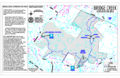 Bridge-creek.jpg 3,400 × 2,199; 2.19 MB
 Cccanalbike.jpg 2,200 × 1,699; 544 KB
 Ccrrwt.jpg 782 × 1,022; 564 KB
 Cctrail-1.jpg 1,076 × 1,439; 602 KB
 Cctrail-10.jpg 1,242 × 960; 128 KB
 Cctrail-2.jpg 1,474 × 1,126; 1.12 MB
 Cctrail-3.jpg 1,474 × 1,126; 1.16 MB
 Cctrail-4.jpg 1,474 × 1,126; 880 KB
 Cctrail-5.jpg 1,474 × 1,126; 654 KB
 Cctrail-6.jpg 1,474 × 1,126; 640 KB
 Cctrail-7.jpg 782 × 1,022; 620 KB
 Cctrail-8.gif 498 × 737; 30 KB
 Cctrail-9.jpg 1,242 × 960; 180 KB
 Chrturkey-cert.png 780 × 1,009; 51 KB
 Chrturkey.jpg 782 × 1,022; 535 KB
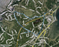
 Chsxc-google.jpg 1,188 × 837; 292 KB
 Chsxc.jpg 782 × 1,022; 622 KB
 Coysbrook-hct.jpg 383 × 567; 41 KB
 Coysbrook.jpg 1,108 × 1,482; 1.2 MB
 Crocker-neck.jpg 2,200 × 3,399; 1.93 MB
 Crowes-den.jpg 1,515 × 2,025; 247 KB
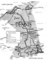
 Denmap.jpg 720 × 600; 105 KB
 Dennisbike.jpg 960 × 1,221; 247 KB
 Duneshacks.jpg 465 × 470; 118 KB
 Ebeach.jpg 600 × 1,260; 96 KB
 Edgill.png 800 × 640; 1.29 MB
 Fcrane-fal.jpg 1,584 × 1,223; 577 KB
 Fcrane-sher.jpg 1,627 × 1,258; 414 KB
 Flaxpond-den.jpg 1,532 × 2,049; 299 KB
 Flaxpond.jpg 589 × 527; 114 KB
 Fn5air.jpg 1,280 × 1,024; 309 KB
 Fn5strt.jpg 1,280 × 1,024; 291 KB
 Foxisland.jpg 5,100 × 6,599; 5.72 MB
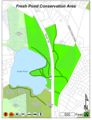 Freshpond-den.jpg 1,561 × 2,043; 352 KB
 Freshpond.jpg 1,108 × 1,482; 534 KB
 Frostfish.jpg 1,223 × 1,635; 1.02 MB
 Frostfish2.jpg 746 × 602; 98 KB
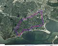
 Goldentriangle.jpg 1,223 × 1,635; 854 KB
 Greatisland-2.jpg 539 × 770; 133 KB
 Greatisland.jpg 660 × 960; 116 KB
 Griffin-2.jpg 542 × 617; 111 KB
 Griffin.jpg 693 × 765; 121 KB
 Harrys-aerial.jpg 1,024 × 768; 155 KB
 Harrys-street.jpg 1,024 × 768; 156 KB
 Harrys-topo.jpg 782 × 1,022; 516 KB
 Hathaways.jpg 571 × 763; 102 KB
 Hawksnest.jpg 960 × 630; 93 KB
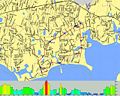
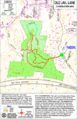
 Headmap.jpg 1,260 × 960; 215 KB
 Herring-river.jpg 931 × 956; 152 KB
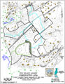
 Horsemap.jpg 781 × 665; 121 KB
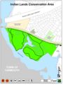 Indian-den.jpg 1,539 × 2,049; 264 KB
 Islandpond-hct.jpg 386 × 567; 57 KB
 Jdefulvio.jpg 572 × 383; 50 KB
 Johnnykelleyrec.jpg 1,108 × 1,482; 593 KB
 Kevins10.jpg 816 × 1,056; 546 KB
 Leebaldwin-hct.jpg 386 × 565; 37 KB
 Leebaldwin.jpg 1,108 × 1,482; 588 KB
 Longpond.jpg 2,200 × 3,399; 1.7 MB
 Longpondres.jpg 913 × 1,291; 153 KB
 Marconi.jpg 720 × 1,140; 101 KB
 Mashpee-river.jpg 955 × 1,177; 183 KB
 Monomoy-river.jpg 567 × 388; 50 KB
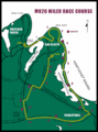 Mv20-2.gif 535 × 721; 29 KB
 Mv20miler.jpg 782 × 1,022; 594 KB
 Mvbike.gif 500 × 560; 30 KB
 Namequoit.jpg 1,108 × 1,482; 489 KB
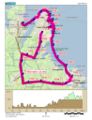
 Nantucket-bike.gif 450 × 345; 24 KB
 Nickerson-1.jpg 736 × 831; 124 KB
 Nickerson-2.gif 758 × 580; 37 KB
 Nickerson-3.jpg 684 × 891; 235 KB
 Oldjail.jpg 2,200 × 3,399; 3.18 MB
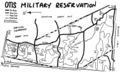 Otismap.jpg 775 × 468; 98 KB
 Pahwah.jpg 1,108 × 1,482; 363 KB
 Paradise.jpg 832 × 538; 104 KB
 Plands-1.jpg 990 × 990; 175 KB
 Plands-2.jpg 737 × 599; 88 KB
 Plands-3.jpg 971 × 856; 179 KB
 Pleasmap.jpg 960 × 720; 116 KB
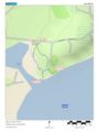
 Pochmap.jpg 420 × 1,200; 93 KB
 Punkhorn-1.jpg 1,020 × 1,140; 200 KB
 Punkhorn-boot.jpg 1,985 × 1,533; 835 KB
 Punkhorn-calf.jpg 2,200 × 1,699; 620 KB
 Punkhorn-eagle.jpg 2,200 × 1,699; 604 KB
 Punkhorn-topo.jpg 551 × 527; 84 KB
 Riverdogs.jpg 768 × 1,005; 445 KB
 Route6.jpg 780 × 840; 135 KB
 Runthehills-topo.jpg 708 × 643; 498 KB
 Runthehills.jpg 800 × 600; 107 KB
 Saltpond-nps.gif 737 × 346; 16 KB
 Saltpond.jpg 780 × 1,080; 151 KB
 Sandmap-2.jpg 3,400 × 2,199; 1.95 MB
 Sandmap.jpg 1,267 × 943; 212 KB
 Sb-topo.jpg 694 × 572; 135 KB
 Shiningsea1.jpg 581 × 727; 122 KB
 Shiningsea2.jpg 1,141 × 720; 197 KB
 Southbeach.jpg 900 × 720; 131 KB
 Sprucehill.jpg 782 × 1,022; 439 KB
 Swanpond-den.jpg 1,538 × 2,043; 230 KB
 Thompsonsfield-hct.jpg 385 × 570; 42 KB
 Togarun.png 800 × 490; 280 KB
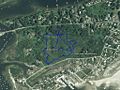 Tomsneck-aerial.jpg 1,024 × 768; 145 KB
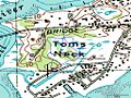 Tomsneck-topo.jpg 1,024 × 768; 165 KB
 Trurhmap.jpg 900 × 1,020; 159 KB
 Trurpmap.jpg 780 × 1,140; 172 KB
 Volunteer-aerial.jpg 1,434 × 643; 146 KB
 Volunteer-topo.jpg 1,434 × 643; 203 KB
 Wegather1.jpg 782 × 1,022; 550 KB
 Wegather2.jpg 782 × 1,022; 569 KB
 Wegather3.jpg 782 × 1,022; 578 KB
 Wegather4.png 483 × 359; 105 KB
 Wellbay.gif 716 × 689; 150 KB
 Wellponds.jpg 1,020 × 1,020; 126 KB
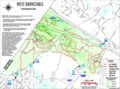 West-barnstable.jpg 2,819 × 2,102; 1.57 MB
 Whelan.jpg 3,400 × 2,199; 1.17 MB
 WRW.jpg 782 × 1,022; 459 KB
 Yarmouthport-5k.jpg 782 × 1,022; 524 KB


